


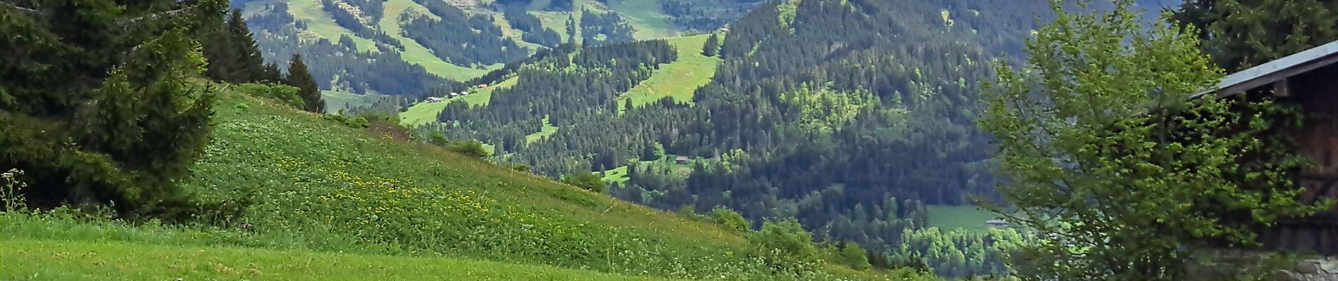
Du Mont Caly au Mont Chéry

micheldutilleul
User
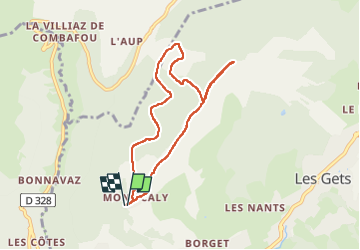

Length
7.4 km

Max alt
1819 m

Uphill gradient
444 m
Km-Effort
13.3 km

Min alt
1464 m

Downhill gradient
444 m
Boucle
Yes
Creation date :
2025-05-26 12:51:41.371
Updated on :
2025-05-26 17:42:39.138
2h02
Difficulty : Difficult

FREE GPS app for hiking
 SityTrail
IGN / Geographical institutes
SityTrail Plus
The world is yours!
About
Trail Walking of 7.4 km to be discovered at Auvergne-Rhône-Alpes, Upper Savoy, Les Gets. This trail is proposed by micheldutilleul.
Photos


Positioning
Country:
France
Region :
Auvergne-Rhône-Alpes
Department/Province :
Upper Savoy
Municipality :
Les Gets
Location:
Unknown
Start:(Dec)
Start:(UTM)
316967 ; 5113665 (32T) N.
Comments